
Real Time Water Level Monitoring
A community and technology partnership for coastal safetyTexas Sea Grant in partnership with the National Science Foundation and the Conrad Blucher Institute at Texas A&M Corpus Christi are collecting data with water level sensors at flood-prone sites.
Overview
Through a partnership with the National Science Foundation, the Conrad Blucher Institute (CBI) at Texas A&M University–Corpus Christi and Texas Sea Grant, researchers at CBI are collecting real-time data with the use of Hohonu water level sensors at flood-prone sites. The data is being used to support timely local responses and to build AI models that help communities plan ahead, protect infrastructure, and adapt to recurring flooding challenges by using the latest AI methods developed by CBI as part of the National Science Foundation’s NSF AI2ES project.
The Challenge
Increasingly routine high water level events, often called ‘nuisance flooding,’ cause water to cover roadways and cuts off access for residents, disrupting daily life, damaging infrastructure, causing strained drainage, and hindering transportation and local commerce, including access to ambulances and medical personnel.
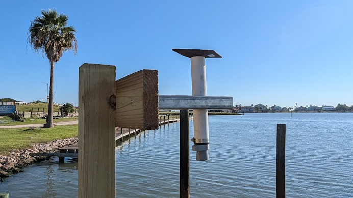
The Water Level Sensor
This station houses a small, affordable water level sensor, leased from Hohonu. This device is a critical part of a research effort to enhance coastal resilience, safety and a thriving economy. It collects real-time water level data every few minutes to forecast sunny-day flooding, helping emergency services and local residents anticipate high water on roadways. This local-to-global data stream helps keep our community safe and informed. Currently, there are water level sensors at five different sites: Magnolia Beach, Six Mile Park, Fish Sargent, Little Bay Marina and Copano Ranch.
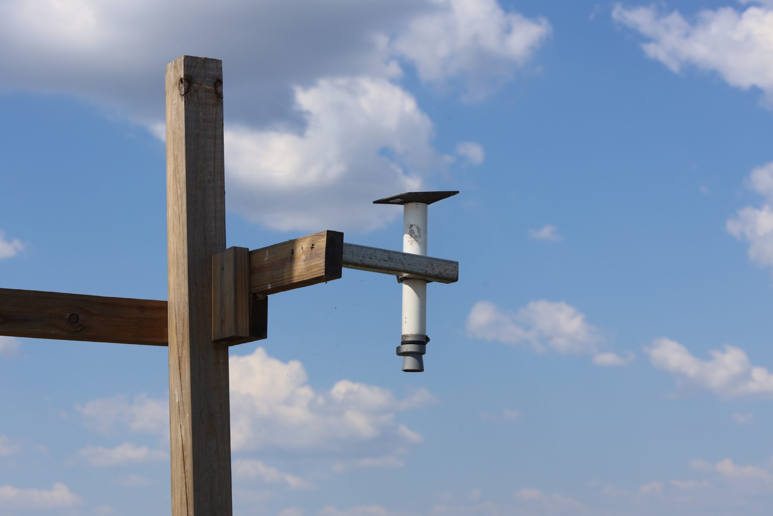
Water level sensor at Six Mile Park
Texas Sea Grant
The Solution
The solution here is community-powered predictions. Researchers at the Conrad Blucher Institute (CBI) use this data to both determine local water level thresholds from community photographs and use the data to train advanced AI models. By matching sensor readings with local photos, we can accurately predict the exact water level when the road becomes impassable (the ‘break point’). This helps everyone plan ahead!
Gallery
Calhoun County Case Study
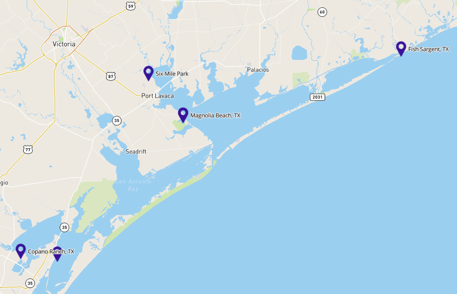
Water Level Sensor Sites and Information as of November 2025
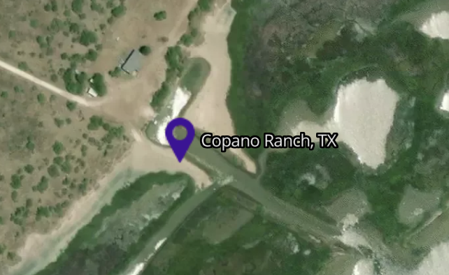
Bayside Copano Ranch (Aransas County) Sensor
Information about the water sensor installed in Copano Bay.
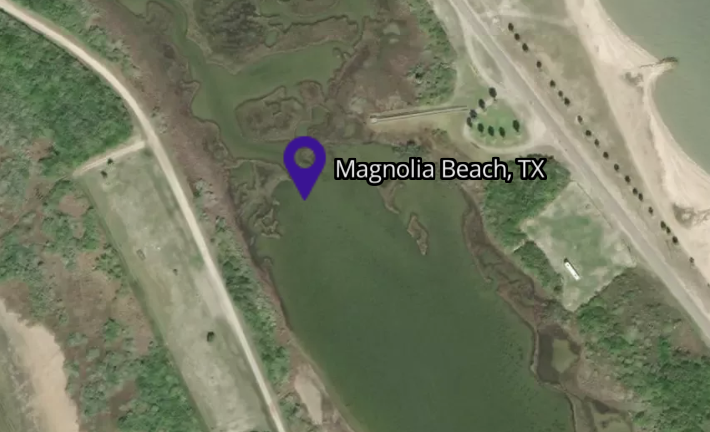
Magnolia Beach (Calhoun County) Sensor
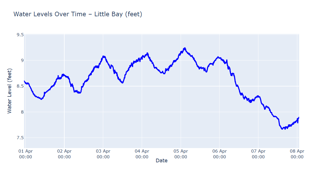
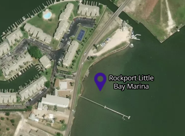
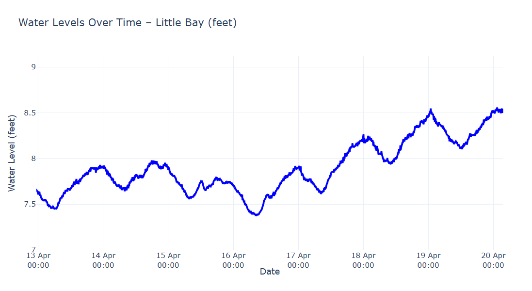
Rockport Little Bay Marina (Aransas County) Sensor
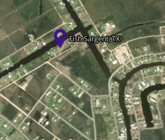
Fish Sargent (Matagorda County) Sensor
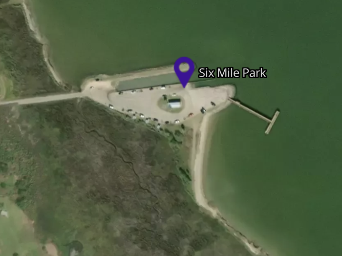
Six Mile Park (Calhoun County) Sensor
Also available in other languages
Products and Resources
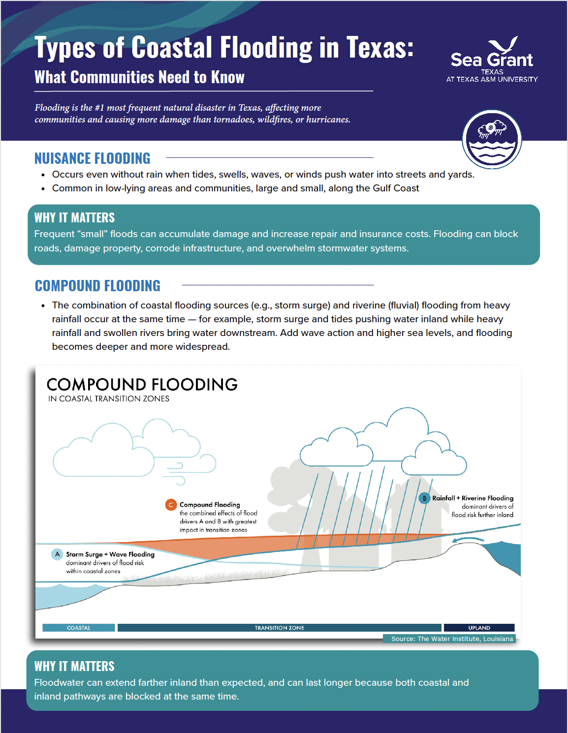
Types of Coastal Flooding in Texas
What communities need to knowContact

April Taylor
Coastal Resilience Specialist Corpus Christi, Texas- april.taylor@tamu.edu
- (361) 825-3225

R.J. Shelly
Coastal and Marine Extension Agent, Calhoun County- rj.shelly@tamu.edu
- (361) 552-9747

Laura Picariello
Director, Texas Sea Grant College Program- lpicariello@tamu.edu
- (979) 845-3902