Research Focus: Water Level Sensors Helping Coastal Communities Stay Ahead of Rising Waters
Along the Texas coast, researchers are using real-time water level sensors to predict “sunny-day flooding” and improve public safety. Led by Texas A&M-Corpus Christi, the project uses AI and local data to warn communities when roads like Ocean Drive in Calhoun County are at risk of flooding.
Aug 1, 2025 By Megan Towery Communications Director
3 minutes
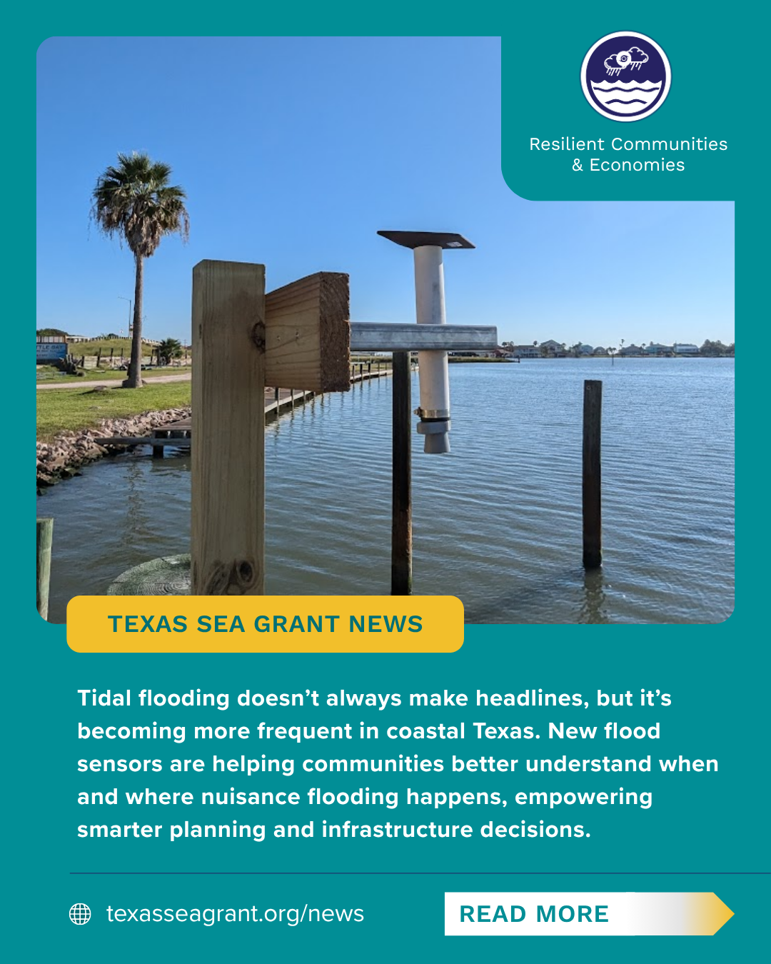
 Water level sensor at Rockport’s Little Bay
CALHOUN COUNTY, Texas — Along flood-prone stretches of the Texas coast, researchers are deploying small water level sensors with big potential: helping communities stay ahead of high water through faster, smarter flood prediction.
Since June 2023, a team led by Dr. Philippe Tissot at the Conrad Blucher Institute for Surveying and Science (CBI) at Texas A&M University-Corpus Christi has installed five sensors at key locations including Six Mile Park, Rockport’s Little Bay, and Ocean Drive near Magnolia Beach. The effort is supported by Texas Sea Grant and the National Science Foundation’s AI2ES program.
Working closely with emergency managers and local residents, extension agents RJ Shelly, Amy Nowlin, and Pat Cruz helped identify the sites where routine tidal flooding most often threatens access and safety.
The goal is to collect real-time water level data and build predictive AI models for “sunny-day flooding.” Sunny day flooding (also called nuisance flooding or high tide flooding) refers to flooding that occurs without rain, usually during high tides or king tides in low-lying coastal areas.
“As coastal inundation becomes more frequent, what tools are helpful?” Dr. Tissot asks. “This project is offering a clear answer: real-time data, in the right place, at the right time.”
One of the most critical installations is on Ocean Drive in Calhoun County, where flooding during high tides routinely cuts off access to about 120 residents near Magnolia Beach. The road becomes especially dangerous at night when emergency vehicles risk delays or getting stuck.
To support the effort, the Magnolia Beach Volunteer Fire Department plays a vital role. When water begins to rise, volunteers take time- and date-stamped photos of Ocean Drive and send them to RJ Shelly, Texas Sea Grant’s Coastal and Marine Resources Agent. Shelly then forwards the images to the CBI research team.
By matching photos to sensor data, researchers can determine the break point, the exact water level at which Ocean Drive becomes impassable. This pairing of quantitative data and visual evidence strengthens the AI model and ensures it reflects local, real-world conditions.
“When we get high tides [on Ocean Drive] it becomes a huge public safety issue,” said Shelly. “Having a model like this here can prevent people from driving into a flooded roadway, or even help first responders get to a scene quicker if they know this particular road is going to be flooded and they need to plan a different route.”
Unexpected Insight During a Storm
Although designed for routine events, the system delivered an unexpected benefit during Hurricane Beryl. As the storm approached, the sensor at Six Mile Park recorded a five-foot drop in water levels, indicating the storm surge was shifting north.
“It wasn’t what the model was designed for, but the Six Mile Park sensor was priceless that night,” said Shelly. “You could tell the storm wasn’t coming here and we had proof in real time.”
Looking Ahead
The AI models will continue to improve as more flooding events are documented with sensor readings and on-the-ground imagery. The goal is to create hyper-local prediction tools that can be shared with emergency managers, road crews, and the public.
Each sensor, leased from Hawaii-based Hohonu for about $3,000 a year, streams data directly to the cloud and updates every few minutes. Their affordability and accuracy have drawn attention from agencies like TXDOT and the National Weather Service, which are exploring their potential for broader flood response planning.
